
![]() Before there was Google Maps, there was Strabo.
Before there was Google Maps, there was Strabo.
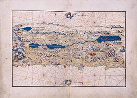
I spent the morning visiting NYU’s Institute for the Study of the Ancient World. Located on the Upper East Side, right next to the MET, the ISAW is an unassuming building on a block full of consulates, condos, and mansions. I came to see Measuring and Mapping Space: Geographic Knowledge in Greco-Roman Antiquity. This is the exhibit for my thesis so I went hoping to see a few pictures, pull a few names to read, and maybe touch an ancient artifact or two. Alas, everything was behind glass (and a security guard shadowed me the entire time I was there). The exhibit two rooms filled with medeival texts typically showcasing Greco-Roman thought or texts containing copies of the writings of Roman and Greek geographers. All the texts were borrowed from local institutions. It always amazes me how many ancient works the NYPL holds.
The tidbit I liked best was the small set of Roman coins on display. The curators explained how the emperors, while minting their money, would use the symbol of the globe to symbolize global domination. It wasn’t just a representation of how the world looked: the globe was a way of showing that the emperor owned everything, even the fantastic lands at the fringes of the world where Griffins and monsters lived. The globe stood as a symbol of imperial propaganda while I’ve always seen globes as antique play things.
When I was little, I would spin the globe really fast and then put my finger down. Where the globe stopped, that’s where I’d “live” when I grew up. The middle of the ocean, the arctic, wherever; I’d live anywhere my finger told me. But I guess that thinking is also a kind of domination – thinking that, no matter where I ended up, I would a) be allowed to live there and b) I would have the technology, skill set, character, and personality, to make it all work. I would have mastered my social domain even if my new friends would be giant squids and those worms that hang around ocean volcanoes.
The exhibit only lasts until January 5 and is free. If you can’t make it, visit online.